
| FAQ | Return to Logistics Page |
|---|
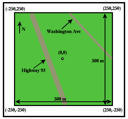
We will define positions within the survey area by using x, y coordinates. Coordinate x represents the position of the point in the east-west direction, and coordinate y represents the position of the point in the north-south direction. Both are measured in meters from the exact center of the survey area. Thus, the 500 x 500 m survey area containts points that vary in x, y location from -250 m to 250 m.
On the figure shown on the left, the x, y coordinates of each of the four corners of the survey area are shown as (x,y). Thus, the southeast corner of the survey area has the coordinates (250,-250).
The geographic coordinates of the survey area are as follows
| FAQ | Return to Logistics Page |
|---|