|
November-December
1998 |
November-December 1998, Vol. 86, No. 6
The Mystery of Cloud Electrification
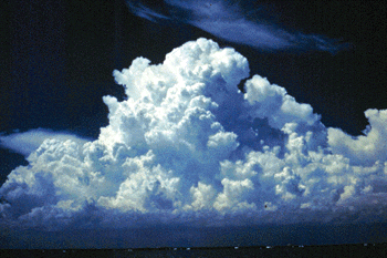
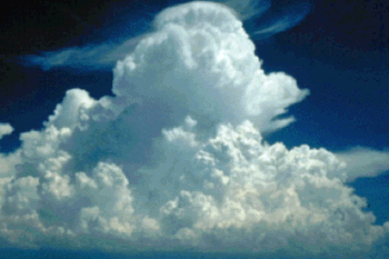
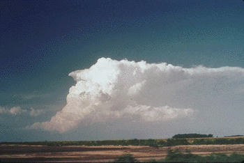
Figure 2. Cumulus cloud over the Florida Everglades (top) grows when moist air from the Gulf of Mexico and the Atlantic Ocean rises over land heated by the sun. As the water-vapor-laden air expands, it cools and the vapor condenses on minute particles, forming the cloud we see. Because the convecting air rises rapidly (much faster than the cloud particles fall), the droplets are carried with the air motion and rise above the freezing level. The same cloud continues to develop and reaches the congestus stage (middle), during which precipitation formation is in its initial stage. A cumulonimbus cloud (bottom), such as this example over Spain, has powerful updrafts capable of carrying water drops well above the freezing altitude, where they become supercooled and eventually form ice particles. (All photographs courtesy of the authors.)
|